Contiguous United States Prism Map
Source: Thingiverse by anoved
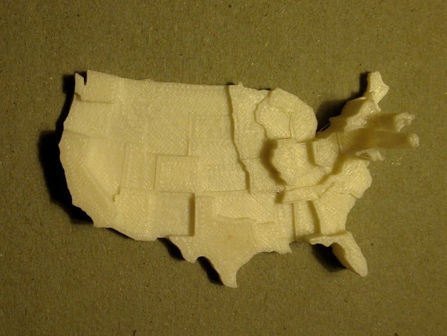
The Contiguous United States Prism Map is a free printable 3D model from Thingiverse by anoved. This is a customizable prism map of the contiguous United States. You can download the STL file from the original listing below and print it at home.

About this model
This is a customizable prism map of the contiguous United States. Values are represented by the extruded height of each state. (An extruded polygon is a prism.) The default dataset depicts population density: 2010 census total population counts normalized by state area in square kilometers. Click Open in Customizer to plug in your own data for each state and to adjust the model dimensions. Create your own customizable prism map models from shapefiles without ease using prismap. Pull requests and bug reports are welcome.
Frequently asked questions
- Is this 3D model free to download?
- Yes. Contiguous United States Prism Map is free to download from Thingiverse. Click the "Download free STL" button above to open the original listing.
- Where is the STL hosted?
- The download is hosted by Thingiverse, not by Thinger. We link you directly to the original listing by anoved.
- Who made this model?
- Designed by anoved, published on Thingiverse. Please credit the creator when sharing your print online.
- Can I print this at home?
- Yes. This model is intended for home FDM and resin 3D printers. Check the original listing for suggested print settings like layer height and supports.
Similar 3D models in Contiguous